It’s been two weeks since we left Las Vegas and pulled into
the Spruces Campground in the Dixie National Forest
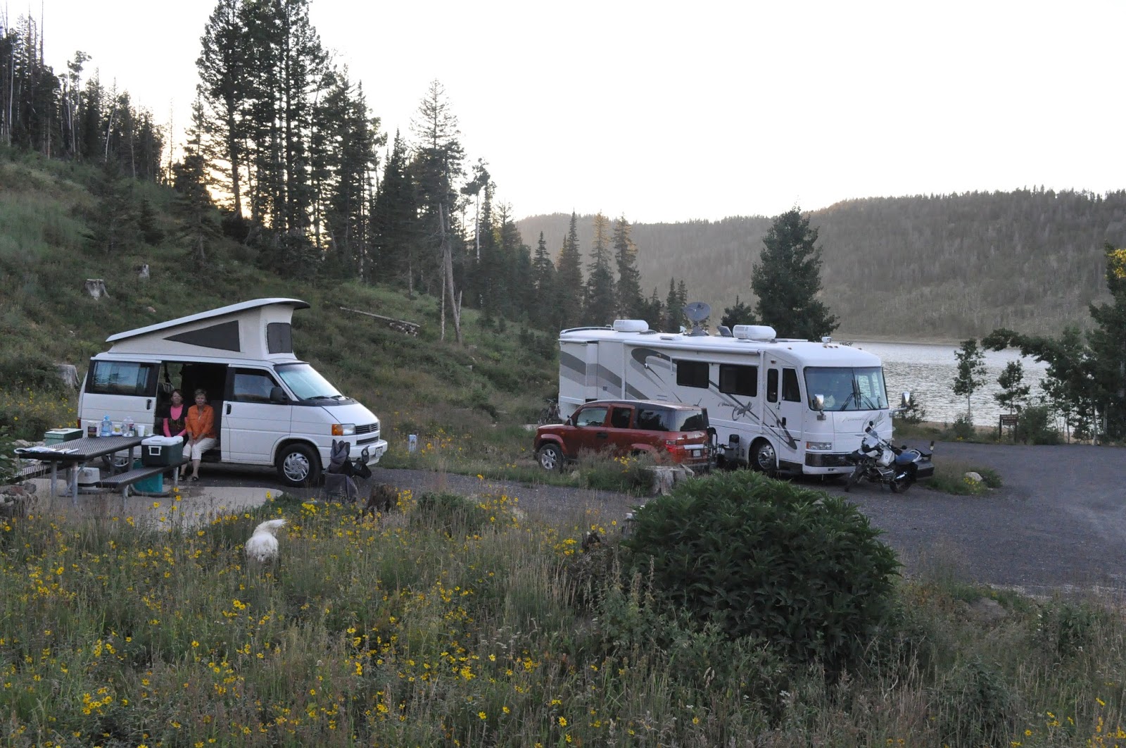
of Utah. Spruces Campground is on
Navajo Lake at 9,200 feet. It’s
early August and the temperatures here have been averaging 70 for the highs and
47 for the lows, the lowest being 37.

Looking across our
camp to Navajo Lake.
After spending some time in Vegas with the 100+ degree
weather and constant use of air conditioning – we both quickly got head colds,
coughs, and a total drain on our energy.
So, although we have mostly slept, coughed, and complained since we got
here – we did have time to read some literature on the area – here is what
we’ve learned:
Originally southwest Utah was called Utah’s Dixie by early residents from the southern states settling in
the desert to grow cotton and silk.
The forest was later named after the area. The forest itself covers nearly 2 million acres of southern
Utah and ranges in altitude from 3,000 to 11,000 feet. It straddles the divide between the
Great Basin and the Colorado River.
Men have inhabited this area since at least 500 AD, starting
with the Anasazi and moving through Paiutes, Utes, Spanish missionaries,
trappers, gold hunters, slave traders, and finally in the late 1800’s, Mormons
who mined iron and coal, and raised cotton and mulberry trees for
silkworms. During this time, large
sheep herds (sometimes 30,000 animals in size) were driven across Utah, to
Nevada and California. Today,
there are still sheep herds, sheepherders, and their trusty sheep dogs to be
seen in these mountains.

Sheep, sheepdogs, and shepherd.
Part of the Grand Circle, the forest has as close neighbors Zion,
Bryce Canyon, and Capital Reef National Parks, Cedar Breaks and the Grand
Staircase-Escalante National Monuments, and Lake Powell. The area is part of the Markagunt
Plateau on the edge of the Colorado Plateau. A large field of stark and abrasive lava beds sit near the
center of the plateau. Only
1,000-5,000 years old, the lava came not from a central volcano, but leaked
from vents in the ground. In
addition to lava rocks, there are lava tubes, sinkholes, craters, and cinder
cones throughout the area. Cinder
cones are small hills formed when mild volcanic eruptions pile debris on the
surface surrounding a volcanic vent.

“Road” into the lava
flows. The large brown-black area
behind the tree line is the lava flow – it’s huge.

Sitting on lava and
feeling very small.

Lava flow with a
cinder cone on the left side.

Lava makes BIG rocks!
We've learned quite a bit about the effects of the Spruce Bark
Beetle. As you travel, it is hard
not to see the many dead spruce trees here in the forest, killed by the spruce
bark beetle – the same beetle killing trees throughout Colorado and the western
states. Until now, all of the places we’ve encountered have done
extensive remediation, trying to save as many trees as they can – so that we
may enjoy the forest as it is today.
But scientists studying the beetle in the Dixie National Forest have a
different approach to the beetle problem.
Instead of eradicating, they see the bug as an agent of renewal in an
old forest. According to a
brochure printed by the park service, the insect is native to the Markagunt
Plateau and other spruce forests throughout the world. Most of the time, the beetle population
is very low, preferring trees downed from windfall or logging. But when forest conditions become right
(lots of big, old spruce trees, not thinned out by fires of other natural
disasters, growing close together), these normally occurring beetle populations
explode to epidemic levels.
Under normal conditions, the beetles bore through the tree
bark and lay their eggs in tunnels chewed in the cambium layer. This is the layer that transports and
stores food and water for the tree.
When the eggs hatch, the larvae feed on the cambium tissue. When they reach adulthood, they emerge
to locate a new un-infested host tree where they can lay their eggs. A healthy tree’s best defense against
bark beetles is its sap. As a
beetle bores into the tree, it drowns in the sap that oozes from the wound, and
the invader is held in check!
However, during an epidemic, thousands of these beetles may infest a
tree - too many for a tree to fend off.
The beetle tunnels cut off the flow of nutrients and water, and the tree
slowly dies.
As bad as that sounds to us – it is a natural part of the
ecosystem. The downside is that we
may live in a time when lots of trees die due to the bark beetle
explosion. The upside of all these
old, mature spruce trees dying, is that that is causes areas of forest floor to
open up, allowing light to get to areas that may not have received much for
decades. These areas are quickly
filled in by groves of aspen, changing the forest to a lighter, airier
forest. In turn, the aspen provide
shelter for young spruce trees that spring up in the open areas below the
mature aspen. This is one method
of forest renewal… as executed by Mother Nature. Of course – it may not necessarily be what you and I prefer
to see in our lifetime. But then,
it’s not all about us – eh!?

Dying and dead spruce
trees.

Sap runs on an
infected spruce tree.

Aspen grove
protecting young spruce trees.
During our first week in the forest Heinz’s Aunt Anne and
her two dogs, Morrie and Lola, joined us from Colorado – despite our colds, the
five of us had a blast.
Anne and the “kids”
(on the left) joining us at the campsite.
On our first full day, Anne, Heinz, and I decided to hike
down to the Cascade Falls via the Virgin River Rim Trail. We took the Spruces Trail from our
campsite uphill (all uphill) around ¾ miles to the Rim Trail and headed
out to the falls. 3.5 miles later
we realized that none of us had remembered to bring the map. The trail at that time was taking a
distinctive turn towards the cliff-side and away from the lake and the
road. Realizing that the road took
you past the parking lot and an easy ½ mile hike down to the falls (we couldn’t
possibly take the short way in, could we?) Anne and Heinz
came to the conclusion that we must have missed a turn-off somewhere and
decided to backtrack. 1.5 miles
later we decided that maybe we didn’t miss a turn-off, but the heck with the falls
- let’s go back home. So we turned
off on the Dike Trail to the lake and headed home. Almost 7 miles and no view of the falls…sigh. I later asked at the Visitor’s Center
and we figured out that the trail made two dogleg turns just before reaching
the falls. We stopped
approximately ½ mile too soon.
Sorry, Anne!!!

Fresh and ready to hike--Anne, Heinz, and Teresa.

Looking over the
Dixie National Forest towards Zion National Park.

Heading along the
Virgin River Rim Trail. The entire
trail runs 42 miles from Cedar City to Strawberry Point.

Wildflowers along the
trail.

Anne taking a break.
Anne taking a break.
The next day we headed down to Zion National Park. Along the way we stopped at the
Thunderbird Hotel and Café in Mount Carmel Junction for a delicious
breakfast. This restaurant is the
home of some special pies as you can see by the photograph.

Anne and Lola,
relaxing on the way to Zion.

The original café was
opened in 1940. At that time, due
to WWII, lumber was scarce and the owners used scrap wood to create their first
sign. There was only room to paint
“Ho-Made Pies” instead of “Home Made Pies”. The sign went up, and has stayed up since.

Heinz deciding on
breakfast, while trying not to spill his coffee. That’s what you get when you “harass” the waitress about
filling your cup.
Zion itself is
desert terrain and we weren’t quite enamored with the heat after the cool
temperatures up at the lake. It’s
ironic then that the area is created by water. North of Zion, rain falling on the 11,000 foot-high Colorado
Plateau runs downhill, pushing its debris off the Plateau’s southern edge. This edge is not abrupt, but steps down
in a series of cliffs known as the Grand Staircase to Bryce Canyon and then
into Zion and the Virgin River. Below
Zion, the Grand Canyon forms the lowest rung into which 90% of Colorado Plateau
waters run. The narrow canyon
carved by the Virgin River is a place known for flash floods, the last fatal
flood occurring only two years ago.

Driving into Zion
National Park.

Along the Riverside
Walk at the Temple of Sinawava at the head of Zion Canyon.

Zion Canyon from the
Virgin River.

Anne and me along the
Riverside Walk.

Getting ready to dip
his feet in the Virgin River.
Over 500 times more species of plants and animals are found
along the Virgin River than in the surrounding arid country where annual
waterfall may only reach 15 inches or less.

Dwarf Daisy along the river.

Narrow-leaf Cattail.

Grasses along the cliffside.

Western Columbine
blooming along the Virgin River.

Silver Shooting Star
back on the desert floor.

Scarlet Indian
Paintbrush along a desert path.
We also spent a couple of days just lounging around the
campsite, chatting, eating, and generally enjoying catching up with one
another.

Posing in front of
the Eagle (what in the world are we looking at?)

And in the "Eagle, Jr."

Morrie checking out
the wildflowers around the campsite.

Lola, protecting the
home base by keeping an eye on any intruders.

And Lola screwing
with Heinz. Hey, wake up old man -
it’s time to play!

Oh yeah - wake me up,
will ya?

I’ll show you!

Ok, Ok… you got way
more energy - you win!!
Heinz has gotten in quite a bit of fishing since Anne
left. As a matter of fact, he’s
gone out just about every morning and evening for the past week, usually
catching his max limit of trout daily.
We’ve got a nice batch of fish in the freezer on top of several fresh
trout dinners.

Planning his strategy.

Ah, this is the
life! Early morning fishing…

…followed by late
evening fishing.

One of his quarry fighting
to the …

… bitter end.

You just can’t buy
them fresher than this.
All in all, this is a beautiful place to kick back, relax,
and rejuvenate. This country has
some beautiful national forests – you gotta get out and enjoy!!

Along Navajo Lake.

Navajo Lake shoreline.

Sky after a rainstorm.

Engelman's Aster.

Coyote Mint.

Sunset over Navajo Lake. (photo by Heinz while evening fishing.)
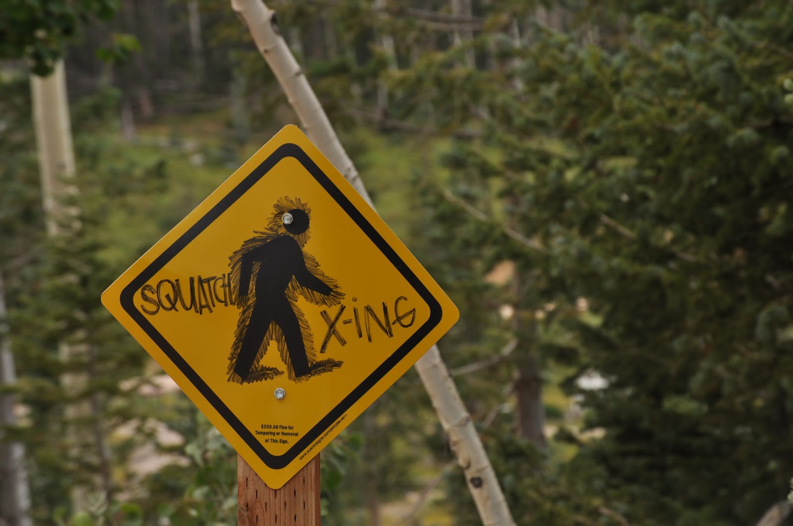
We have more adventures here in the Dixie Forest, but I’ll
leave them for next time. So
here’s a few of our friends of the day to keep you company for now.

Just how long do I
have to pose? Sheesh!

Well, I don’t
actually have a picture of the deer, but the culprit took out all the lettuces,
basil, flowers, and parsley from my traveling garden. Picky eater left the green onions and peppers. Oh well, I’ll replant after we get out
of the forest!

Rats, you spotted me!

Here, let me show you
how this whole camouflage thing works.

And for a more intimate “friend”, sometime yesterday, a
critter yet to be determined, entered our home on the lake. We have not seen him/her, but the
tell-tale signs are there… scratching behind a cabinet, and the unforgiveable
sin of nibbling on Heinz’s All Natural Fruit (with artificial flavors)
Blackberry Pie. Unlike the Spruce
Bark Beetle – this one WILL BE remediated before long (though pictures may not
be appropriate at that time).


