My apologies to all, the wifi has been pitiful for the past week or so. But, on with our saga! The past few weeks flew by. Heinz and I
spent another few days in the Dixie National Forest
kicking back with some easy hikes and good fishing.
We finally took that ¾-mile hike from the parking
lot down to the Cascade Falls. The falls come from water leaving Navajo
Lake via a lava tube and tumble down to the head of the Virgin River. It
was a hot day and the trail was crowded, but we persevered and made it all the
way to the end. What a shocker when we got there and the falls were dry –
zip… zilch… nada! We were kind of happy that we'd never reached them the
day of the 7-mile hike; that would have been a real disappointment! But
the views were great and the exercise felt good after almost two weeks of lying
around being sickly.

The trail runs just below
the Markagunt Plateau rim, but is a fairly level, easy hike.

Seth Canyon from the
Cascade Falls trail.

The Falls… Ummm...where's
the water?


Only evidence of water at
the falls – I think somebody spit there.
While we didn't go, MammothCave is a popular spot to explore in the Dixie Forest. It is a
lava tube that is located just a few feet underground and extends approximately
a ¼-mile. The cave is dark, so bring your flashlight. It is
frequented by seven species of bats; including two endangered species - the
Townsend's Big-eared Bat and Fringed Myotis. The cave is closed in winter
to protect the bats, as disturbing their hibernation can lead to their death.
While staying in the forest we took a day and drove
over to Cedar Breaks National Monument.
The Monument is located just down the road between the edge of the Dixie
Forest and Cedar City, Utah. It was created in 1933 to protect the Cedar
Breaks Amphitheater, a vast expanse of colorful rock formations. Shaped like a huge coliseum, the
amphitheater is over 2,000 feet deep and over three miles in diameter. Stone spires stand like statues in a
gallery alongside columns, arches, and canyons. These formations are the result of persistent erosion by
rain, ice, and wind. Varying
combinations of iron and manganese give the rock its different colors of red,
yellow, and purple.


We don’t have any
really good photos of any friends of the day, so I’ll leave you with some
flower shots instead.


Panorama shot of the
Amphitheater from Point Supreme at 10, 350
feet elevation.
We also drove up to Brian Head Peak Overlook. At 11, 307 feet, the overlook provides
views from which you can see parts of Utah, Nevada, and Arizona.

Looking south.

Northern view from the
overlook.

Amazingly, even at this
altitude tiny wildflowers were blooming; the yellow ones are called Chamber’s
Twinpod.
Heinz got in more fishing during our last week in
the forest. He went down to the
lakeshore every morning and evening, stocking our freezer with plenty of trout,
39 total. Of course, that doesn’t
count the eight we cooked and enjoyed along the way…yep, that’s 47 trout in two
weeks time. He had a blast, and I
loved the fresh fish, especially since he also cleaned them! What a man!

But I’m too young to
go! Pick somebody else!

Not bad for a couple of
hours spent enjoying the outdoors.
After leaving the Dixie National Forest we traveled
the huge distance to Bryce Canyon National Park
- a whole 80 miles. On our first
night there we drove back outside the park to Red Canyon and hiked the Pink
Ledges Trail at sunset. The trail
is short (one mile), but winds along the canyon through a shady pine forest and
past several hoodoos. A Paiute
Indian myth says that people who lived in Bryce Canyon long ago teased the god
Coyote, who in turn became angry and turned the people to rock.

Hiking along the Pink Ledges Trail.

Red Canyon hoodoos.

Red Canyon at sunset.

Moonrise on the way home.
However, as nice as the tale is, geology tells us
another story. Hoodoos are tall
skinny spires of rock that protrude from the bottom of arid basins and “broken
lands”. They are most commonly
found in the high plateaus of the Colorado Plateau and in the Badlands region
of the Northern Great Plains. In
common usage, the difference between hoodoos and pinnacles or spires is that
hoodoos have a variable thickness or “totem pole shaped body”. A spire has a smoother profile that
tapers from the ground upward.
Hoodoos don’t last very long in geologic
terms. The same processes that
create them, erosion of relatively soft rock by rain and frost wedging, also
conspire to destroy them. The
average rate of erosion is calculated at 2-4 feet every century. The primary weathering force is frost
wedging. The hoodoos at Bryce
Canyon experience over 200 freeze/thaw cycles each year. In the winter, melting snow seeps into
the cracks and then freezes at night.
When water freezes it expands by almost 10%, prying open the cracks bit
by bit - widening them over time.
Rain also sculpts the hoodoos.
Rainwater is slightly acidic which allows the weak carbonic acid in the
rain to slowly dissolve limestone grain by grain. It is this process that rounds the edges of hoodoos and
gives them their lumpy profiles.
On our first full day in Bryce Canyon we headed out
on a hike from our camping spot to the Rim Trail, down to Navajo Loop Trail,
around the Queens Garden Trail and back to camp, a total of around 4
miles. The trails descend from the
canyon rim 550 feet to the bottom of the canyon floor and back up again. Along the way are graveled switchbacks,
impressive rock formations, bristlecone pines more than 1, 000 years old, and
forests of pinyon pine and juniper.

Queen's Garden from the Rim Trail with Sinking Ship Mesa in the distance on the right.

Natural Bridge from the Rim Trail.

Navajo Trail hoodoos.

Panorama of Bryce Canyon from the Rim Trail.

Heading down the Navajo Loop switchbacks, 550 feet to the bottom.

Caught in the rain, we took shelter under a convenient overhang.

Checking the view between two hoodoos.

The Queen's Garden trail.
On our second day, we
decided to see the canyon from a different angle, and to let someone or
something else do the walking. So
off we went to sign up for a canyon trail ride. We headed out on horseback with a group of 10 - one of 4
groups to head out that morning.
It was a fun 2 hours, for which we paid over the next couple of days
whenever we sat down.

Hmm, not sure this is really Heinz’s thing. It’s his second time ever on horseback.

On the other hand, all those years of riding as a kid came right back to
me.

These guys were so familiar with the trail all you had to do was give
them their head and let them go.

Bristlecone Pine along the trail, estimated to be 1, 500 years old. The pine grows about 1” in diameter
every 100 years. The oldest known is
approximately 5, 000-years old.

The cones of the Bristlecone Pine are 3-3½” in length and deep chocolate
brown when mature. Immature cones
are longer and drip a thick yellowish sap.

Dead trees in the canyon with twisted trunks were not killed by
wildfire, but were struck by lightening.
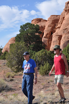
After three nights at
Bryce Canyon we packed up and headed for Grand Junction, CO. We were there to pick up my dad who has
been visiting his girlfriend for the past 3 months. We celebrated his 92nd birthday this week. I know…92 and a girlfriend…age is NOT
slowing this man down. He met
Miriam 73 years ago while working on the Colorado National Monument with the
Civilian Conservation Corps (CCC) during the Great Depression. Both widowed, three years ago they
re-contacted with each other and have been calling, writing, and visiting ever since.
He kept us busy from the
time we hit town with dinners out, lunches at the retirement center, and trips
about the area.
On Saturday, we took in
the Dinosaur Journey Museum in Fruita, CO. The museum tells the story of dinosaur
life in western Colorado with real fossils, cast skeletons and robotic
reconstructions of dinosaurs. The
museum is a hands-on, interactive museum and all the kids there seemed to be
having a blast - while it’s still very interesting for adults. There is a working laboratory where
dinosaur bones are prepared for display, a collections room where scientists
conduct research on field finds, and a simulated earthquake ride among other
displays.

Foot cast of a Tyrannosaurus Rex.

Velociraptor skeleton.

Flying trio of skeletons.

Daddy said he’d always wanted to ride a dinosaur, so we gave him the chance!
On Sunday there was a
small birthday party for Daddy at the retirement home. We had a great lunch followed by
cheesecake for dessert. Just after
everyone had finished up the cheesecake, the chef brought out a five-layer,
chocolate birthday cake. No
problem, we just served up cake and dug in again.

Daddy and Miriam checking out his birthday greetings on Facebook.

Now that's a birthday cake!

Where is he going to put that?
We took two trips up to
the Colorado National Monument with Daddy so he
could show us his old stomping grounds from his days with the CCC. We had a blast wandering around the
area where the camp had been located.
During the Great
Depression, the 73rd Congress, in March 1933, authorized the
Emergency Conservation Work program.
In 1937 the continuation of the program was approved and the name was
officially changed to the Civilian Conservation Corps.
The CCC was one of several
federal relief programs, which sought to alleviate distress caused by the
massive unemployment of the 1930’s.
The program achieved this through the establishment of camps where young
men worked on forest and conservation projects throughout the country. The program was a cooperative effort
between the Departments of War, Interior, Agriculture, and Labor. The War Department was responsible for
the building of the camps and for providing food, clothing, medical care, and
transportation for the enrollees.
The Interior Department provided educational programming for enrollees,
supervised work done in the National Parks and other federal lands, and
cooperated with the states on work done in the state parks. The Agriculture Department supervised
work in connection with soil conservation, reclamation, wildlife protection,
and other conservation projects.
The Labor Department was in charge of enrollee selection upon the
recommendation of state relief agencies.
The CCC was open to young
men between the ages of 17 and 23 whose families were in special need. The enrollees earned $30/month of which
$25 was sent home to their families.
The usual enrollment was for a six-month term while the maximum term of
service was two years. My Dad
signed up with the CCC in 1940 in Texas and was sent to the Colorado National
Monument to help work on the building of the Rim Road. He spent 1½ years working in the
kitchen, feeding 150 men three meals a day. According to him that was “sure better than being out on a
work crew chiseling rock all day”.

Rim Road through Fruita Canyon, part of the road built by the CCC
through the Colorado National Monument.

Erica and Sandi, friends of Daddy's. Erica is head ranger at the monument.

Heinz and Daddy looking around the old campsite. Among the rocks we found quite a few
rusty nails, the main evidence of multiple buildings that were torn down in the mid-1940's.

Found! A 73-year-old water
fountain.

We felt like archeologists, the remains of the old road through the
campsite.
The Colorado National
Monument was created in 1911. The
Rim Road travels 23 miles through plateau and canyon country. It rises over 2,000 feet above the
Colorado River and is part of the greater Colorado Plateau. It is semi-desert land of pinion pines,
and junipers, desert bighorns and coyotes. It is an amazing place of beauty!

Parade of the monoliths.

Independence Monument, climbers go up this monument every July 4 to plant flags at the top.

Daddy and me checking out the scenery. (photo courtesy of Sandi)

Utah Juniper.

Looking down Ute Canyon toward the Grand Valley.
Our other major expedition
out was to Dinosaur National Monument just
outside of Vernal, Utah. The area
has been known since the early 1900’s for dinosaur fossils found in the rock of
the Morrison Formation. Laid down
from 147-155 million years ago, outcroppings of this rock occur in eight
western states. The Carnegie Quarry at Dinosaur National Monument has yielded a
wealth of fossils. It has produced
fossils from all four major Late-Jurassic dinosaur groups: plant-eating
sauropods, stegosaurs, ornithopods, and flesh-eating theropods. Fossil pollen and spores now identify
250 species of plants from the Morrison ecosystem. Fossils show that dinosaurs lived at the same time as clams,
snails, algae, crayfish, insects, salamanders, frogs, turtles, crocodiles, and
small mammals.
The Carnegie Institute in
Pittsburgh, PA began excavating fossils in this area in 1909. In 1915 the Carnegie Quarry’s
world-class bones were protected as the 80-acre Dinosaur National Monument. In today’s 210,000-acre national
monument you can explore the quarry and the canyons, mountains and
archeological sites by the historic Green and Yampa Rivers.

Dinosaur fossils embedded in the stone at Carnegie Quarry.

This Allosaurus skull was found in the Carnegie Quarry. Skulls are very fragile and complete
ones hard to find – this is the most complete skull ever discovered.

Daddy and Miriam by a femur.

Juvenile Allosaurus.

Desert big-horn sheep by the Green River.

Petroglyphs in Dinosaur National Monument. Scenes like these might make you think of aliens arriving.

More petroglyphs.
After a week in Grand
Junction, it was time to pack Daddy up and start to head south. But we’re taking our time about it and
on day one drove 118 miles southwest to Arches National Park. So stay tuned to read about our
adventures – we’ve got two weeks and lots to see.

Apache Plume.

Indian Blanket.

Bull Thistle.

Coyote Mint.

Colorado Columbine.
No comments:
Post a Comment