Have you noticed that we keep circling back to Anchorage? Well, it’s not that we’re that enamored
of Anchorage, but to get anywhere in southern Alaska, you have to go through the city.
If you look at the map of the state below, you’ll notice that there
aren’t too many highways in Alaska.
Most of them are centered in or around Anchorage. That’s also the reason we’re only
traveling in the south-central portion of the state. There are no highways out to the western portion - it’s only
accessible by boat or air. The
southeastern islands around Juneau are accessible only by ferry (very costly for an RV).
The northern portion of the state has one “highway” that
stretches 414 miles from Fairbanks to Deadhorse on Prudhoe Bay. It was originally built as a supply
road to support the Trans-Atlantic Pipeline System in 1974. The highway parallels the pipeline and
is one of the most isolated roads in the U.S. There are only 3 towns along the route: Coldfoot (pop. 10),
Wiseman (pop. 22), and Deadhorse (pop. 25). Fuel is available at mile 56, at Coldfoot (mile 175), and 239
miles later at the end of road in Deadhorse. To quote the Alaska Highway
Department: “The road is very primitive and small vehicle and motorcycle
traffic carries significant risk.
Anyone embarking on the route is encouraged to bring survival
gear.” Gosh, can’t imagine why I
didn’t want to take off on that drive!
This is actually a “destination” road for motorcyclists coming up from
the lower-48. Considering that the
road is desolate, with no services for hundreds of miles, making it to Deadhorse
is a badge of honor for some motorcyclists – Heinz decided to pass.

Highway map of Alaska.
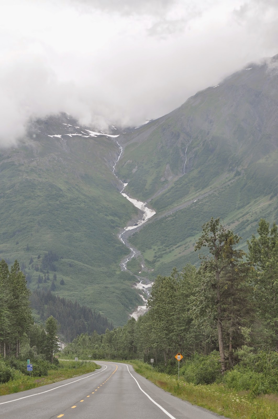
We’re still enjoying this area of Alaska. We recently headed south out of
Anchorage turning our eyes toward Valdez.
Along the way, Heinz wanted to stop at Matanuska Glacier,
chosen by Alaska Magazine as #2 of
“49 Places to go in the 49th State”. Matanuska is the largest glacier that can be reached by
vehicle. A valley glacier, it is a
body of solid ice that flows like a river under its own weight through an
existing valley. Matanuska Glacier
Park is a privately owned park that has the only public access point to the
glacier. You can drive up to the
parking area, then walk on foot onto the ice, explore the glacier on your own,
or choose to take advantage of one of the local guide companies. We decided to go out on our own. We did not have any crampons – spiked
attachments for the soles of your shoes that make walking on ice much easier. Not having crampons made for some interesting moments trying
to figure out the best route, with the least amount of black ice, clear ice,
blue ice, rocks, boulders, mud, crevasses, etc. We’ll probably go back when Heinz’s cousin gets here in
August and I think we’ll spring for the guided tour (with crampons) next time.

Matanuska Glacier, 27 miles long by 4 miles wide,
seen from Glenn Highway.

Trekking through the moraine to get to
the glacier.

Backpack-check,
camera-check, gloves/jacket/scarf-check, hat-check.
OK, I’m ready to go!

Standing at the
edge of the ice you feel very small.

Glacial flour. Ground by glacial ice from solid rock
to very fine particles, this material then flows out from beneath a glacier in
the meltwater.

Black ice on
the glacier, very slippery!

Crevasses in the ice.

Close-up of a
crevasse. This one is only about 10”-12”
wide, but you can’t see the bottom. Others are large enough to lose a person forever.

Blue ice in Matanuska
Glacier.

Me standing on
the terminal moraine (accumulation of rock, clay, and gravel at the outermost
edge of a glacier).

Matanuska
River, formed by glacial melt.
When we got down to Valdez we planned on around 3 days in
town, next thing we knew, we’d spent a week in the area. One of the most important ports in
Alaska, the year-round population of Valdez is about 4,200. Located on Prince William Sound the
town is a port for both commercial and sport fishing. Freight moves through Valdez bound for the interior of
Alaska. Sightseeing in Prince
William Sound and heli-skiing are major sources of tourist income. In addition, Valdez is the terminal for
oil from the Trans-Alaska pipeline and the port from which it is shipped to
refineries around the world.
Valdez was started in the late 1800’s as a scam to lure
prospectors off the Klondike Gold Rush trail. Some steamship companies promoted the Valdez Glacier Trail
as a better route for miners to reach the Klondike gold fields and set up
sleeping and eating accommodations at the end of Port Valdez Fjord. The prospectors who came found that
they had been deceived. The
glacier trail was twice as long and steep as reported, and many died attempting
the crossing. Once the Richardson
Highway was completed in 1899, connecting Valdez and Fairbanks, Valdez shook
off its unsavory reputation and became the first overland supply route into the
interior.
In the 1964 Good Friday Earthquake liquefied the glacial
silt that formed the town’s foundation forming a massive underwater landslide,
which resulted in a section of the shoreline breaking off and sinking into the
sea - causing a 30-foot high tsunami.
Thirty-two residents on the city’s main freight dock were lost. After this, the city moved to more
stable ground 4 miles away and the old town site was destroyed.

Valdez town limits cover
277.1 square miles for a population of 4,022.
One of several
glacial melt waterfalls just outside of town.

Heading into
Valdez through the Chugach Mountains.

The small boat harbor,
filled with charter boats, commercial fishing boats, kayaks, and privately
owned pleasure boats. Commercial
cargo ships and tankers use a different deep water harbor.

Nets on a commercial
fishing boat.

Chugach
Mountains surrounding Valdez from across the fjord.
This year marks the 25th anniversary of the Exxon
Valdez oil spill. The spill
occurred as the oil tanker Exxon Valdez
was leaving the terminal at Valdez full of oil. Approximately 25 miles into Prince William Sound the ship
ran aground on Bligh Reef spilling 11 million gallons of oil and devastating
much of the marine life in the surrounding area. This is an amount roughly equivalent to 17 Olympic-sized
swimming pools. Approximately
1,300 miles of shoreline were contaminated. It took more than 4 summers and $2.1 billion dollars before
authorities shut down the operation.
At its peak the cleanup included 10,000 workers, about 1,000 boats and
roughly 100 airplanes and helicopters.
Industry representatives claim that everything is now fine in the
area. However, government and
university studies estimate that at least 20,000 gallons of oil still remain
and will be present for at least another 25 years, if not longer.
Many species of animals, birds, and marine life have slowly
recovered from the spill, but many have not. The list of those considered to have recovered include among
others: bald eagles, common loons and murres, cormorants, pink salmon, river
otters, and sockeye salmon. Among
those that are still on the slow road to recovery include harlequin ducks,
harbor seals, killer whales, sea otters, rockfish, and black oystercatchers. Two species that have shown no sign of
recovering are Pacific herring and pigeon guillemots.


Bald eagle on the
wing.
After the oil spill, several changes were made in how oil
tankers are managed until they cleared Prince William Sound and enter open
seas. All tankers transporting oil
in the Sound are now required to be double-hulled. All tanker captains, and any crewmember suspected of
consuming alcohol are now subject to alcohol tests before sailing. Crews receive more training and work
hours are limited to reduce accidents caused by fatigue. The Coast Guard now
monitors the speed and heading of all tankers and other vessels in Prince
William Sound through improved radar.
The Exxon Valdez left the existing tanker traffic lane because of
reports of ice drifting into the lane from the nearby Columbia Glacier. One of the many improvements to help
avoid such problems includes the installation of an ice-detecting radar system
on Bligh Island.
In addition, all tankers are required to have two escort
tugs. One tug is required to be attached to the tanker at all times. These tugs are designed to keep a
disabled tanker off the rocks and carry equipment to begin immediate cleanup if
a spill occurs. These tugs are extremely
powerful. On it’s own power, a
fully loaded tanker takes about seven miles to come to a stop. These tugs can stop a tanker inside of
one length of the tanker – I would not want to be onboard when it comes to that screeching halt!

Oil tanker being
escorted out of the Sound by tanker tugs. The yellow tug is attached to the tanker.
So, just how does the oil get to Valdez? The Alyeska Pipeline Company was
founded in 1970 to design, construct, operate, and maintain a pipeline to
transport oil from the field on the North Slope of Alaska to the ice-free
deep-water port in Valdez. The
pipeline was built between March 1975 and June 1977, running 800 miles from
Prudhoe Bay to the Marine Terminal at Valdez. The first barrel of oil traveled through the pipeline in
1977, and full-scale production began by the end of the year. Several notable incidents of oil
leakage have occurred since; including those caused by sabotage, maintenance
failures, and accidental gunshot holes by hunters. As of 2013, the pipeline had shipped almost 17 billion
barrels of oil. The maximum daily
throughput was 2,145, 297 barrels on Jan. 14, 1988. Decline in oil production is now posing a serious problem
for the pipeline. By 2015, it is
anticipated that daily oil throughput will approach less than 500,000 barrels
per day unless additional sources of oil are developed. By law, Alyeska is required to remove
all traces of the pipeline after oil extraction is complete. As of today, no date has been set for the
removal.

A cold and wet me
standing under the Alyeska Pipeline (better known as the Trans-Alaskan
Pipeline). Approximately 420 miles
of the pipeline is elevated on 78,000 vertical supports. The radiators on top of each post are
designed to keep the permafrost at the bottom of the post from thawing out.

Terminal storage facilities outside of Valdez.

The first barrel of
oil pumped through the Alyeska Pipeline on July 28, 1977.
While in Valdez we took a day and enjoyed the Meares Glacier
Excursion offered by Stan Stephens Cruises. A 9-hour tour, the boat travels across Prince William Sound,
past the Columbia Glacier and Glacier Island, to Unakwik Inlet and Meares
Glacier. The glacier is one mile
wide where it ends in the inlet.
It is also one of the few glaciers in Alaska that is advancing rather
than retreating. We had a great
trip out with some interesting scenes along the way.

The
Northwestern. This is one of the
boats featured on the TV program Deadliest
Catch. During the summer
months it travels to Prince William Sound and acts as a go-between tender
between fishing boats and the processing facility.

Mining probe
along the shoreline. Miners began
exploring for copper and gold in Prince William Sound around 1900. Some ore was found, but better deposits
elsewhere caused interest to decline.

Waterfall along the
shore.

Sea otter checking us
out.

Humpback whale spouting.

And then diving.
And then, oh my, we arrived at the glacier.

Ice in Unakwik Inlet.

More ice
floating in Unakwik Inlet.
Remember, only 10% of an ice floe is above water, this one was around 20
feet from end to end.

Sea otters on
the ice, staying safe from killer whales.

And then, there it
was, Meares Glacier, 1 mile wide and ½ mile deep.

Harbor seals
lounging on the ice in front of the glacier. It’s a great spot for avoiding predators.

Checking us out
while we checked him out.

Hmm…you’re getting a bit
close for comfort!

Later, dudes…

Ice floating
away just after calving off the glacier.
Ice calving is the breaking off of chunks of ice at the edge of a
glacier due to the movement of the glacier body. Calving is often accompanied by a loud cracking sound that sounds
like a loud thunderclap. The entry
of the ice into the water causes large, and often hazardous, waves, so boats
often cannot approach closer than 1-2 miles.

Hanging out in
front of Meares Glacier.
Along the way back to Valdez we got to see some other really cool things.


Completion of the flipper
slap. The black shape on the right
is the left side of the whale’s tail.

Humpback whale beginning to breach. A breach is where a whale generates enough upward force with
its flukes to lift approximately 2/3 of its body out of the water. Researchers believe it may be related
to courtship or play activities.
While this one was beautiful to watch, just before it we were treated to
the spectacular sight of two whales
breaching side by side. I don’t
think anyone on board got a photograph; we were all too busy ooh-ing and
ahh-ing.

Dall’s Porpoise
with calf playing alongside the boat.
Dall’s Porpoise are found only in the north Pacific. They can swim up to 33mph and dive to
300 feet. They have never been
observed to sleep by researchers.
We found a wonderful little museum in Valdez, the Whitney
Museum. Maxine Whitney came to
Alaska in 1947 with her husband.
Over the years she traveled to Native villages throughout the territory,
buying items directly from the artists to sell in her gift shop. She continued to collect artwork for the
next 40+ years. In 1998, Maxine
donated her collection to Prince William Sound Community College. The college built a state-of-the-art
museum to house the collection.

Native
waterproof coats made of bear gut (left) and seal gut (right).

Mammoth tusk
carving. Notice that each sled dog
is different.

What are
considered to be typical Alaska Native dolls were created only recently to sell
to outsiders. These were made for
Maxine’s niece.
While in Valdez Heinz talked
to the locals and found a great place to fish. Allison Point is across the inlet from town and close to the
salmon fishery, so there are tons of salmon trying to get back to their
birthplace to spawn. The pinks
were running and Heinz put some great food on the table, not to mention taking
me along to get some great photos.

Heinz and I agree, this is how we’ll
always picture Alaska…fireweed, water, and mountains.

The seagulls also agree that this is a great
spot for fishing.

As well as the bald eagles. There must have been at least 40, if
not more, eagles hanging out and chowing down.

Even if he doesn’t catch anything, how can
you not love fishing in a setting like this?

But as I said, he stayed busy
putting food on the table, not to mention into the freezer.
After leaving Valdez we
headed east to Wrangell-St. Elias National Park. At 13.2 million acres, this is the largest park in the
National Park system and one of the least visited. Wrangell-St. Elias stretches from one of the tallest peaks
in North America, Mount St. Elias (18,008 feet) to the ocean. Yet there are only two roads into the
park, both packed dirt/gravel. At
the northwestern end Nabesna Road-42 miles- leads to several camp sites,
hiking, and wildlife viewing areas.
If
you’re interested in history, take the Edgerton Highway on the southwestern end
of the national park to Chitina (pronounced chit na). At a population of 126, this is not the booming town it once
was. In 1900 copper ore was
discovered along the northern edge of the Chitina River valley. This brought a rush of prospectors and
homesteaders to the area. By 1914
there was a railroad, stores, stables, 5 hotels, several rooming houses, bars,
restaurants, and a movie theater.
The mine closed down in 1938 and Chitina became a ghost town. Current activity in town revolves
around the dipnet fishing for salmon every summer and the few tourists that
stop on their way to see the Kennicott mine.

Abandoned trucks in town.
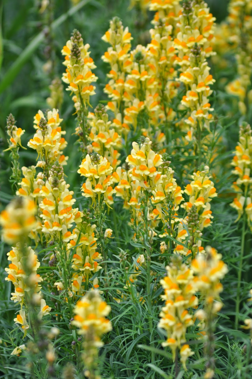
Butter and Eggs blooming in the
middle of town.

Photo of prospectors and an almost pure
copper find, circa 1908.
Leaving
out of Chitina, the McCarthy Road takes you along 56 miles of dirt road into the
towns of McCarthy and Kennicott. Both
of these were railroad and mining towns or were until the copper ore ran
out. At one time there was even a
hospital and a grade school in Kennicott.
Now there are approximately 40 year-round residents.
In
1900 two prospectors spotted a green patch on the side of Mount Kennicott that
turned out to be one of the richest deposits of copper ore ever found. Bought out by a consortium backed by
the Guggenheim brothers and J.P. Morgan, the Kennecott Corporation (I’m not
messing up my spelling…the town is spelled with an “i” and the corporation with
an “e”) started mining operations in 1906. The next hurdle was to transport the copper ore from the mine
to the coastal town of Cordova where it would be shipped to Tacoma, WA for
smelting.
The
railroad (owned by the Kennecott Corporation) was built in 1908 and stretched
196 miles from Cordova to the Kennecott mines. In Cordova, the ore was shipped by way of the Alaska
Steamship Company (also owned by the Kennecott Corporation), to the smelters in
Tacoma, WA (also owned by the Kennecott Corporation). Nothing like a good old
American monopoly is there?
Over the next 30 years, approxiomately
$200,000,000 worth of copper ore would be extracted. By 1938 the price of copper had dropped too low and the ore
was running out so the mine was closed and the railroad abandoned. In November of that year the last train
departed from Kennicott taking the last of the ore and most of the residents
with it, leaving two ghost towns behind.
While in Kennicott we walked
around, but saved the mine tour for later this month when our guests
arrive. So you’ll hear more about
Kennicott later.


Abandoned winch system across the river.

Abandoned railroad.

Mine tailings
stretch for miles.

Ghost town.

But all that abandoned equipment does make some interesting
flowerpots for the locals.
We’re now back in Anchorage for a few days until we head out
to find a lake, some fish - maybe some trout or char this time - and some peace
and quiet. It’s also the beginning
of berry picking season, so I’ll need to poke around and see what I can find.

Salmonberry.
Leaving you for now with our friends of the day.

We went to toss the trash
one day and decided it wasn’t our turn.
Maybe later!

Yak burgers on the
hoof. I tried one in Chitina and
found it to be very tasty, much like almost fat-free ground beef.

Aw, come on people,
I’m trying to nap here.

Furs for sale
in one of the local shops. Now this should make
PETA nice and happy.

Along with
this…funny, when I think about it we haven’t seen any PETA members around here.

Stellar Jay who
wasn’t happy when we settled in next to his nest.

Our national
bird chilling on an ice floe.
(Sorry, couldn’t resist).
No comments:
Post a Comment